Fowey to Lantic Bay Trail
England · Cornwall · 5.9 miles (round trip) · ~2 hrs 53 min–3 hrs 32 min (round trip)
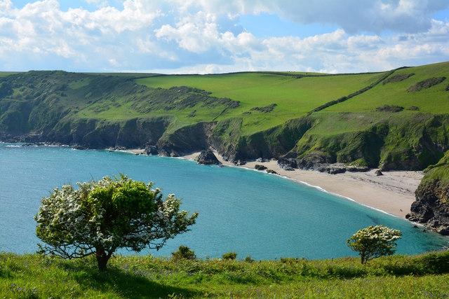
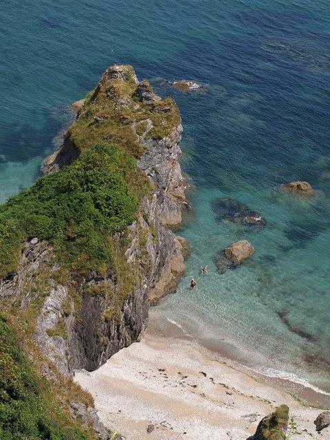
Great Lantic Bay
Lantic Bay near Polruan
Footprints on the beach
Great Lantic Beach
Lanteglos church
Church of St Wyllow, Pont
House by Pont Pill
Route and Terrain
The route is a mix of woodland footpaths, field edges, and quiet lanes. As we tested it, we found the paths well-maintained but expect them to be muddy after rain. There are several steep, hilly sections as you climb out of the creek valleys, which can be challenging, but the route is clearly signposted. It is a fantastic walk, though it involves navigating two ferry landings which can be slippery at low tide. Sturdy footwear is definitely recommended, especially for the sections passing through the woodland bordering Pont Pill.
Sights & Experiences
This is easily one of the most scenic walks in Cornwall. The journey takes you along the tranquil, green waters of Pont Pill creek, an area so untouched it feels like stepping into another era. Throughout the walk, you are treated to mesmerising, panoramic views of Fowey Harbour, with its mix of working china clay ships, local fishing boats, and yachts. The climb up to St Saviour's Hill provides a brilliant vantage point to look back over the entire estuary. You pass through vibrant woodland, open fields that often host grazing livestock, and charming coastal sections that offer sweeping vistas of the South Cornish coast.
Hidden Gems
The isolated hamlet of Pont is a true highlight; once a bustling quay for coal and grain, it is now a peaceful, secluded spot perfect for pausing to watch the tide. Keep an eye out for the 'Q' memorial above Penleath Point, a beautiful tribute to the novelist Sir Arthur Quiller-Couch, which offers one of the most stunning, quiet viewpoints along the entire route.
History & Heritage
This route is steeped in local history. The path takes its name from the 'Hall' estate that once dominated the area. Pont Pill was historically a vital industrial artery, used to transport timber and agricultural goods. You will also pass Lanteglos Church, a beautiful historic site with deep local connections, and the route itself was a favourite of many literary figures who found inspiration in the quiet beauty of the estuary villages.
Seasonal Changes & Best Time to Visit
Spring is glorious here, with bluebells carpeting the woodland, while autumn brings fantastic colours. Be mindful that ferry timetables change seasonally and can be affected by weather. Winter is quieter, but paths become significantly muddier.
Parking & Public Transport
Parking in Fowey town centre is very limited; avoid driving into the narrow streets. The best options are the 'Main' car park (steep walk down to town, or use the minibus) or 'Caffa Mill', which is ideally located for the Bodinnick Ferry.
Safety & Preparation
Ensure you have sturdy walking boots and check ferry times before you set off. Keep dogs under close control as there is often livestock in the fields. The paths are generally safe, but watch your footing on steep or muddy sections.
Difficulty & Alternatives
Moderate. While the distance is manageable, the steep climbs make it more taxing than a flat coastal stroll. There are plenty of benches to rest on. If you're struggling, the ferries offer a way to shorten parts of the loop, but the full four-mile circuit requires a reasonable level of fitness.
Insider Tip
Don't rush! We recommend finishing your walk in Polruan with a well-earned pint at one of the local inns before catching the passenger ferry back across to Fowey. It’s the perfect way to soak in the harbour atmosphere.
Recommended Shops & Pit Stops
Fowey and Polruan are packed with excellent cafés and pubs. You’ll find plenty of spots for a cream tea or a hearty meal after you finish your loop.
Walk Characteristics
Parking
Route Map
Enjoy finding wild, beautiful places?
The OS Maps app is a must. Offline maps, route planning, and detailed Ordnance Survey mapping for all UK walks. Try free for 14 days.
Some links may be affiliate links. We may earn a small commission at no extra cost to you.