Lantic Bay Pencarrow Head Walk
England · Cornwall · 1.4 miles (round trip) · ~36 min–45 min (round trip)
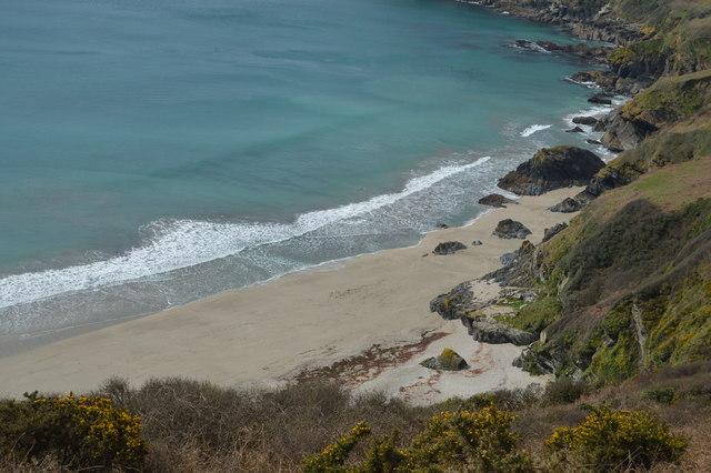
Lantic Bay in May near Polruan, Cornwall
Lantic Bay
looking out onto Lantic Bay
Lantic Bay
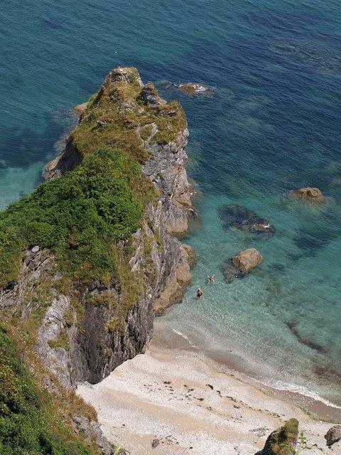
Lanteglos: Lantic Bay and Pencarrow Head
The South West Coast Footpath above Lantic Bay
Lanteglos: towards Great Lantic Beach
Beach at Lantic Bay
Lantic bay
Route and Terrain
We found the walk from the National Trust car park to the beach mostly follows well-maintained field paths and coastal tracks. However, the final descent to the shore is notably steep, involving a long flight of steps that can be taxing. The terrain underfoot varies from compacted gravel and grass in the fields to more rugged, rocky patches near the cliff edge. While the paths are generally clear, they can become slippery after rainfall, so sturdy footwear with good grip is essential for the climb back up, which we felt was a genuine workout.
Sights & Experiences
The scenery here is truly breathtaking, often compared to tropical islands for its striking white sand and brilliant turquoise water. We spent time admiring the views of the craggy coastline stretching toward Pencarrow Head and the Fowey Estuary. The bay itself is a sheltered, crescent-shaped cove framed by dramatic, high cliffs. On the walk down, we observed plenty of coastal birdlife, including oystercatchers and stonechats. The beach is split into Great Lantic and the smaller, more precarious Little Lantic, with rugged rock pools perfect for quiet exploration.
Hidden Gems
If you venture west of the main Great Lantic Beach, you will find two smaller, sandy coves. We advise extreme caution if you try to reach them, as they are only accessible by climbing over rocks and you can easily be cut off by the rising tide.
History & Heritage
This stretch of coast has a fascinating, if rugged, history. During the 18th and 19th centuries, these coves were hotspots for smugglers bringing contraband like brandy and tobacco ashore, hidden away from prying eyes. The nearby village of Polruan also retains a medieval character, with its ancient castle ruins dating back to the 14th century.
Seasonal Changes & Best Time to Visit
Spring and autumn are arguably the best times to visit for birdwatching and avoiding the summer crowds. In winter, the cliff paths can be particularly exposed and muddy, so we recommend sticking to dry, clear days.
Parking & Public Transport
The primary access is via the National Trust Lantic Bay car park. It is a large, level site with a compacted gravel surface. Parking is free for National Trust members; others must pay via coins or the JustPark app. Mobile signal can be patchy, so we suggest downloading the app before you set off. There are no toilets here; the nearest facilities are at the Lantivet Bay car park about a mile away.

Safety & Preparation
The beach has no lifeguards and strong rip currents; do not swim on a falling tide. Pack plenty of water and snacks, as there are no facilities at the beach level. Wear sturdy boots for the steep return climb.
Difficulty & Alternatives
We would classify this as moderate to strenuous. While the initial field walk is straightforward, the final cliff descent is steep and may not be suitable for those with mobility issues or young children who struggle with long flights of stairs.
Insider Tip
The climb back up is deceptively exhausting! We recommend carrying your gear in a sturdy backpack to keep your hands free for the steep steps, and definitely bring more water than you think you will need.
Walk Characteristics
Parking
Route Map
Enjoy finding wild, beautiful places?
The OS Maps app is a must. Offline maps, route planning, and detailed Ordnance Survey mapping for all UK walks. Try free for 14 days.
Some links may be affiliate links. We may earn a small commission at no extra cost to you.